
How to get to us when you arrive in Prague?
- By car: Take highway D1 (Prague – Brno). If you go south from downtown in direction Brno, take exit Spořilov (marked in red colour in the upper figure) and immediately another exit Spořilov; coming from Brno, take exit Spořilov (marked in blue in the upper figure). Then follow the dashed red and blue line to the Institute.
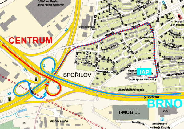
Map of the neighborhood of the Institute (denoted IAP) useful when arriving by car
- By train or bus: From the Hlavní nádraží main railway station, the Holešovice railway station, and the Florenc main coach station, take underground line C, direction Háje; from the Masarykovo nádraží railway station, take underground line B to station Florenc and change for line C, direction Háje. Get off at station Roztyly. When you get to the surface, you will already see buildings of the Institute behind the highway. The walk takes about 10 minutes and leads right of the OBI supermarket through a highway underpass. The path is depicted by red line on the bottom map of the neighborhood of the Institute.
- By plane: From the Prague-Ruzyně airport you can take taxi or go by public transport. The journey takes about 60 min in both cases, in the former case depending on the traffic density. If you decide to go by public transport, take bus No.119 to the bus terminal Dejvická. Then take underground line A to station Muzeum and change for line C, direction Háje. Get off at station Roztyly. When you get to the surface, you will already see buildings of the Institute behind the highway. The walk takes about 10 minutes and leads right of the OBI supermarket through a highway underpass. The path is depicted by grey line on the bottom map of the neighborhood of the Institute.

Map of the neighborhood of the Institute (IAP) and a way from Roztyly station to IAP (grey line).
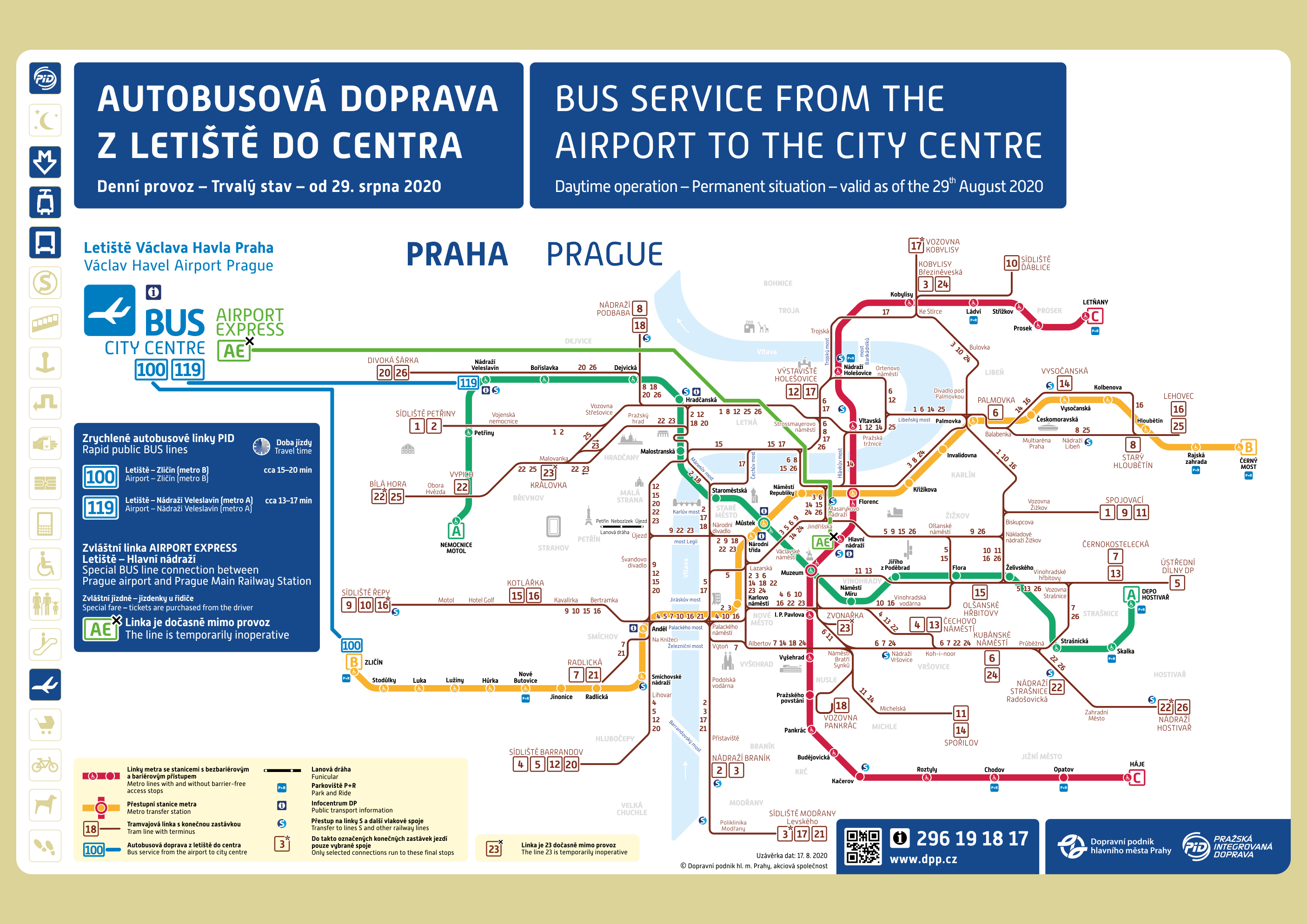
Metro map with a connection to airport and scheme of the public transportation in Prague (underground lines are in red, green and yellow)
- Useful links:
- http://www.mapy.cz – maps of the Czech Republic and Prague
- http://www.dpp.cz – Prague city transport, timetables
- http://www.praha-mesto.cz – information about Prague